
Bangalore
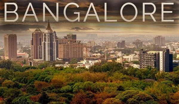
Bangalore is India's main software capital and the state headquarters of Karnataka, standing 920 meters above sea level with 14 million people. It accounts for over 35% of all Indian tech exports through major work hubs like Whitefield and the Outer Ring Road.
The high ground keeps the air cool and mild in all seasons. Daily temperatures mostly stay between 15°C and 34°C. Top schools like the Indian Institute of Science and green parks like Cubbon Park sit right here. Fast new trains and fresh jobs pull many families and young workers into the city every week.
Historical Roots: From Mud Fort to Modern Capital
Bangalore began in 1537 with a mud fort built by Kempe Gowda I, a local ruler under the Vijayanagara Empire. He marked the town’s boundaries with four watchtowers. Some of these old towers still stand today, including those near Lalbagh and Mekhri Circle.
In 1761, ruler Hyder Ali rebuilt the old mud walls with solid granite stone. His son Tipu Sultan added a wooden summer palace near the fort as a cool resting place. The British took control of the fort in 1791, later building the Cantonment zone with wide roads and colonial parks.
Global Gateway: Kempegowda International Airport (BLR)
Kempegowda International Airport stands 35 km north of the city at Devanahalli, covering over 4,000 acres of land. It ranks as the third busiest airport in India, handling over 40 million travelers each year.
Terminal 2 opened as a special garden terminal built with eco-friendly bamboo, indoor waterfalls, and hanging plants. It holds world green awards and uses full green energy. Work is now underway on the new metro line that will link airport gates right to the city train grid.
Defining the Metropolis: Bengaluru vs Bangalore
Bengaluru vs Bangalore shows the official name change from an old British spelling to a local Kannada word, signed by the state on November 1, 2014. Old stone rocks from the 9th century found in Begur call this area Bengaval-uru, or the City of Guards.
An old story tells of a lost king who ate hot boiled beans from an older woman in the woods, naming it Benda-Kaalu-Uru. State offices, train stations, and bus boards now write Bengaluru. At the same time, top tech firms and news sites across the globe still type Bangalore.
Geographic Layout: Bangalore Directions and City Zoning
Bangalore directions cut the full city into four clear parts that spread out from the busy Majestic bus stop:
- North Bengaluru: Areas like Hebbal, Yelahanka, and Devanahalli stretch towards the airport. The area also has large aerospace and aircraft parts companies.
- South Bengaluru: Jayanagar, Basavanagudi, and JP Nagar are known for quiet streets, old coffee shops, and tree-lined parks.
- East Bengaluru: Whitefield, Bellandur, and Marathahalli have many large IT parks and are home to many software workers.
- West Bengaluru: Rajajinagar and Malleshwaram have old markets, popular food spots, and good metro access.
Strategic Coordinates and Bangalore Pin Code Framework
The middle Bangalore location sits on the world map at 12.9716° N, 77.5946° E on high, dry land in South India.
The postal office puts clear numbers on each area so mail carriers drop off letters and parcels with no fuss:
- Every Bangalore PIN code starts with the three digits 560, followed by three local area digits.
- The General Post Office in the city heart takes 560001, while tech centers like Bellandur use 560103 and Whitefield has 560066.
- Big factory areas like Electronic City hold 560100, and north hubs like Yelahanka take 560064.
Regional Transit and Bangalore Distance Reference
Bangalore distance charts show the normal time it takes to drive between key points on main roads and flyovers:
| Trip / Route | Distance (km) | Main Road / Mode | Normal Travel Time |
|---|---|---|---|
| Majestic to BLR Airport | 35 km | NH 44 (Bellary Road) | 50 to 65 mins |
| Majestic to Electronic City | 22 km | Hosur Road Flyover | 40 to 50 mins |
| Majestic to Whitefield (ITPL) | 24 km | Metro Purple Line / Old Airport Road | 45 to 60 mins |
| Hebbal to Silk Board | 21 km | Outer Ring Road (ORR) | 45 to 70 mins |
| Bengaluru to Mysore | 143 km | NH 275 (10-Lane Highway) | 75 to 90 mins |
Civic Pulse: Infrastructure Upgrades and Citizen Welfare
City leaders and ward teams meet each month to fix tar roads, lay water pipes, and run local buses on time. Open web portals and local halls let normal folks share ideas on daily traffic, waste pick-up, and street safety.
Resident groups take part in ward talks to help plan footpath work, clear drain blocks, and plant shade trees. These open meetings help road engineers find street holes and fix simple town tasks fast.
Investment Potential Across Emerging Corridors
Bangalore homes bring in strong rental yields of 3.8% to 5.5% each year, which tops the 2% to 3% rate seen in other big Indian towns. High-paying IT jobs along Outer Ring Road and Sarjapur Road make it very easy for flat owners to pick good tenants.
Land and home prices are climbing quickly in North Bangalore near Bagalur and Devanahalli. New business plots, cargo yards, and fast airport roads keep pulling in smart buyers each year.
Latest Infrastructure News and Transit Updates
The new Satellite Town Ring Road (NH-948A) is now open for 80 km in the north from Dobbaspete past Doddaballapur down to Hoskote. This road pulls big cargo trucks away from inner city lanes. Workers are now finishing the next bit from Hoskote down to Hosur.
The state is also pushing ahead with the 73 km long Business Corridor to tie Tumkur Road to Hosur Road with 11 wide flyover loops. At the same time, metro teams are laying steel tracks for the Blue Line to tie Silk Board straight to the airport terminal.
Urban Living Benchmark: Purva Cityspire on the Bellandur Tech Corridor
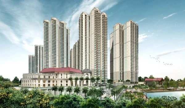
Purva Cityspire is a premium high-rise home project by Puravankara Limited, located in Bellandur, East Bangalore (pin code 560103) right on the Outer Ring Road. The gated layout covers 6 acres of land and features two tall towers of G+35 and G+38 floors with around 500 flats.
| Project Feature | Purva Cityspire Details |
|---|---|
| Project Location | Bellandur, Outer Ring Road, Bangalore - 560103 |
| Total Land Area | 6.0 Acres |
| Tower Structure | 2 High-Rise Towers (G+35 & G+38 Floors) |
| Total Residences | Around 500 Flats |
| Unit Configurations | 1 BHK, 2 BHK, 3 BHK, and 4 BHK Modern Homes |
| Open Green Space | Around 55% Total (~45% Central Grass Parks) |
| Clubhouse Size | 20,000 sq. ft. Sky Clubhouse |
| Starting Price | From ₹97.5 Lakhs* onwards |
| Base Price Rate | ~₹13,000 per sq. ft. |
Home Sizes and Floor Plans
- 1 BHK Flats: Sizes run from 700 to 800 sq. ft., making them a neat fit for single IT staff, with rates from ₹97.5 Lakhs.
- 2 BHK Flats: Sizes run from 1,150 to 1,400 sq. ft., built with two full baths, a bright dining hall, and sunny balconies.
- 3 BHK Flats: Sizes run from 1,700 to 2,100 sq. ft., giving big master rooms and wash spots for families with kids.
- 4 BHK Flats: Large luxury homes run from 2,600 to 3,200 sq. ft., made with extra study rooms and wide front halls.
Green Grounds and Club Facilities
- Open Spaces: About 55% of the 6-acre site stays open to the sky, with more than 45% filled with soft grass, shady trees, and clean stone paths away from cars.
- Clubhouse: A big 20,000 sq. ft. club offers a clean swimming pool, gym room, yoga floor, steam bath, shared work desks, and an event hall.
- Outdoor Play: The project has tennis courts, safe play spots for small kids, and clean walking tracks for pet dogs.
Travel and Work Hub Connections
- Nearby IT Parks: Stands only 900 meters from Helios Business Park, 4 km from Pritech Park SEZ, 4.5 km from RMZ Ecospace, and 5.7 km from Embassy TechVillage.
- Road Access: Opens right onto the Outer Ring Road and sits only 1.6 km from National Highway 44.
- Metro and Train: Rests 1.7 km from the new Kadubeesanahalli Metro stop on the Blue Line, 1.7 km from the bus stand, and 2.9 km from Bellandur Road train station.
- Airport Route: Cabs can take NH 44 straight to Kempegowda International Airport over an easy 47.5 km drive.
FAQs
Bangalore is called India's Silicon Valley because it set up the nation's first tech parks and top research schools like IISc. Big home brands like Infosys and Wipro grew up here, and the city sends out over 35% of all Indian software today.
Bangalore is one of India's costlier cities for flat rents, mostly in IT spots like Bellandur, Indiranagar, and Koramangala. Even so, daily food, local bus tickets, and vegetable markets stay cheap and fit any basic budget.
Bangalore is famous for its busy startup teams, cool breezes, craft food cafes, and green parks like Lalbagh and Cubbon Park. It also stands tall as India's main hub for space study, plane making, and science labs.
Bangalore's oldest written name is Bengaval-uru (City of Guards), carved on a 9th-century stone in Begur village. People later said Benda-Kaalu-Uru (Town of Boiled Beans) before the British wrote it as Bangalore, and the state changed it to Bengaluru in 2014.
Bellandur uses 560103, Whitefield uses 560066, Electronic City uses 560100, and Hebbal uses 560024.